Here is how to view this information:
Point your web browser to the Steuben County GIS.
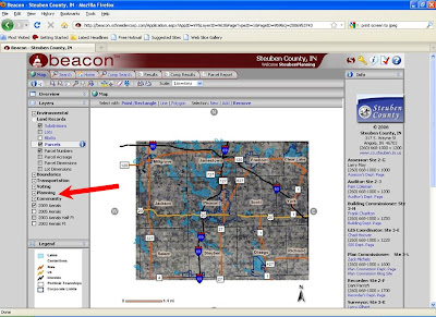
When you get to the map, open the "Planning Menu" on the left-hand side by clicking in the small box with the "+" on the left hand side of "Planning". (Illustrated by the red arrow below.)

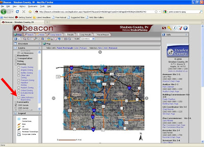
This will open up several new options for you to select. Scroll down the menu on the left until you see "Lakes Advisory Board Area." Select this by clicking the open box on the left of "Lakes Advisory Board Area." (Illustrated by the red arrow below.)

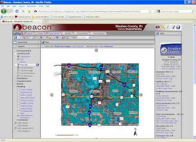
The Lakes Advisory Board Area is now shown with a blue color overlaying the map. This area is especially important for the water quality of the many lakes in Steuben County.

The Lakes Advisory Board was created by the Steuben County Plan Commission to advise it on proposed projects within this area.
The Plan Commission would like to thank GIS Coordinator Chad Hoover for his efforts developing this feature.


